Cendrawasih Bay National Park
 |
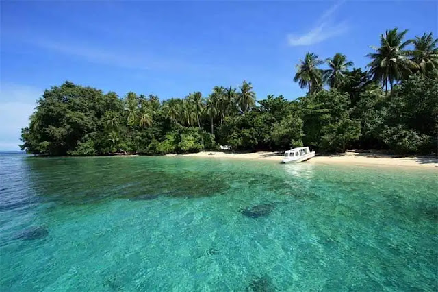
| Cendrawasih Bay (photo: traveloka.com) |
The marine area of Cenderawasih Bay has a diversity of flora and fauna that is spread both on land, on islands and in the surrounding sea waters. This area also has the function of protecting the life support system. Given the importance of this area, through the Decree of the Minister of Forestry Number 58/Kpts-II/1990 dated February 3, 1990, this area was declared a Marine Nature Reserve area. About three years later, this conservation area was designated as Cenderawasih Bay Marine National Park through the Decree of the Minister of Forestry Number 472/Kpts-II/1993 dated September 2, 1993.
Cenderawasih Bay Marine National Park (TNTC), with an area of 1,453,500 Ha, is the largest Marine National Park in Indonesia. Geographically, this area is located between 1° 43"- 3°22" South Latitude and 134°06" – 135°10" East Longitude. Administratively, this area is in the area of two regencies, namely Teluk Wondama Regency and Nabire Regency. The area included in the Wondama Bay Regency is about 80 percent of the total area of TNTC.
The TNTC area stretches from the Auri Islands chain from the east of Tanjung Kwatisore in the south to the north on Rumberpon Island. It includes 500 Km of the coastline of the Main Island of Papua with its coral reefs and coastal areas and coral reefs of the 18 islands that are in the core zone, protection zone and limited use zone. The 18 islands are: Nuburi Island, Papaya, Nutabari, Kumbur, Anggromeos, Kabuoi, Rorado, Kuwom, Matas, Rouw, Iwaru, Rumarakon, Nusambier, Maransabadi, Nukup, Paison, Numerai, and Wairundi.
The land and water areas within the TNTC area can be broken down as follows:
- Mainland = 68,200 Ha, consisting of: Coastal = 12,400 Ha (0.9%) Mainland Islands = 55,800 Ha (3.8%)
- Waters/sea = 1.385.300 Ha, consisting of: Coral Reefs = 80.000 Ha (5.5%) Sea = 1.305.300 Ha (89.8%)
PURPOSE/FUNCTION OF THE AREA
The purpose of establishing TNTC is to maintain and preserve the function of the area and to preserve the diversity of flora and fauna species and their ecosystems in the area. The function of the TNTC area is to protect the life support system, to support the sustainable use of living natural resources and their ecosystems, and to be used for research, science and education purposes, to support cultivation, tourism and recreation.
MANAGEMENT SYSTEM AND MANAGEMENT BOARD
National Parks are natural conservation areas that have native ecosystems, managed with a zoning system used for research, scientific, educational purposes, to support cultivation, tourism, and recreation. The zoning system consists of a core zone, utilization zone, and other zones according to need. (Law No. 5 of 1990).
Cenderawasih Bay National Park is managed by a zoning system. The zoning division of the area can be seen in the picture/map with a brief description as follows:
- Core Zone
Is a strict protection zone, which functions to protect species and areas with high conservation value, such as rare or threatened or endangered habitats and species; sensitive habitats that are weak to disturbance; areas used to protect breeding stocks of species that may be used, and good/intact samples of natural habitat types.
- Protective Zone
The location of the protective zone around the core zone. Its purpose is to protect the core zone and serve as a buffer from activities in other zones so that it does not have a direct impact on the core zone.
- Limited Utilization Zone
It is an area for traditional use of natural resources by local residents for the benefit of daily living as well as by visitors/immigrants but with certain supervision and restrictions so as not to damage habitat or take protected, rare or endangered species.
- Buffer Zone
It is an area outside the zones mentioned above and is designated for security and other activities.
Based on the Decree of the Minister of Forestry No.185/Kpts-II/1997, the management organization of TNTC is the Cenderawasih Bay National Park Center (BTNTC). The organizational structure and work procedures of this Balai refer to the Decree of the Minister of Forestry No. 6186/Kpts-II/2002 concerning the Organizational Structure and Work Procedure of the National Park Office.
Comments
Post a Comment